The Tread® - Overland Edition is a rugged and versatile 8” all-terrain sat-nav designed for adventurers and off-road enthusiasts. With its high-brightness HD color TFT display, the device ensures clear visibility in various lighting conditions, and its multi-touch interface offers intuitive navigation and control. This sat-nav is built to withstand harsh environments, featuring a MIL-STD-810 drop rating, IPX7 water rating, and IP6X dust rating. The Tread® is equipped with comprehensive outdoor navigation tools, including preloaded topographical maps, US public land boundaries, and motor-vehicle-use maps for various off-road vehicles.
Advanced features such as BirdsEye Direct Satellite Imagery, Garmin Real Directions™ landmark guidance, and Garmin Adventurous Routing™ enhance navigation accuracy and provide a detailed view of your journey. The device supports point-to-point and turn-by-turn trail navigation, making it ideal for both planned routes and spontaneous off-road adventures. With compatibility for backup cameras, Bluetooth® pairing, and smart notifications, the Tread® ensures you stay connected and informed throughout your travels.
KEY FEATURES
- Dimensions: 8.1" W x 6.7" H x 1.2" D (20.7 x 16.9 x 3.1 cm)
- Weight: 22.8 oz (646 g)
- Water Rating: IPX7
- Dust Rating: IP6X
- Display Type: Multi-touch, glass, high brightness HD color TFT with white backlight
- Display Size: 6.8" W x 4.2" H (17.2 cm x 10.8 cm); 8" diagonal (20.3 cm)
- Display Resolution: 1,280 x 800 pixels
- Dual-Orientation Display: Yes
- Mounting: Locking magnet-assisted mount; 1.5" ball adapter with AMPS plate
- Drop Rating: MIL-STD-810
- Battery Type: Rechargeable lithium-ion
- Battery Life: Up to 6 hours at 50% backlight; Up to 1 hour at 100% backlight
- Internal Storage: 32 GB
- External Memory Storage: Yes (256 GB max microSD™ card)
- Preloaded Maps: Street maps, topographical maps, US public land boundaries, private land parcel maps (parcels >4 acres), USFS Roads and Trails
- Downloadable Satellite Imagery: Yes (BirdsEye)
- TOPO Map Support: Yes
- Sensors: GPS, Galileo, Barometric altimeter, Compass, 10 Hz multi-GNSS positioning
- Outdoor Recreation Features: Point-to-point navigation, Navigate-a-track navigation, Turn-by-turn trail navigation
- Camera Features: Backup camera compatible (BC™ 50)
- Navigation Features: Garmin Real Directions™ landmark guidance, TripAdvisor® Traveler Ratings, Route shaping, Includes traffic (with Garmin Tread app), Lane assist with junction view, Bluetooth® pairing
- Advanced Features: Smart notifications via app, Wi-Fi® map and software updates, Access to live services (traffic, weather, etc.), GARMIN ADVENTUROUS ROUTING™, Motorcycle or powersports specific POIs, Elevation profile, Round trip routing, Service History Log, Custom map support
- RV Features: Specialized routing for vehicle size and weight, RV Parks & Services directory, Road elevations, Speed limit changes, Easy Route Planner with GPX file sharing
- Adventure Features: Built-in inReach® Technology (requires subscription), Pair with Garmin PowerSwitch™ digital switch box, External GPS and inReach® satellite antenna compatibility, Group Ride Mobile (with Garmin Tread app), Track recorder (breadcrumbs), iOverlander™ POIs, Ultimate Public Campgrounds, Pitch and Roll gauges, Birdseye Satellite Imagery (download via Wi-Fi), Glove-friendly touchscreen
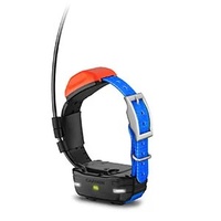
- Outdoor Applications: Dog tracking (when paired with compatible dog track system)
| SKU | GM126166LP |
| Model # | 010-02508-20 |
| Barcode # | 753759277581 |
| Brand | Garmin |
| Shipping Weight | 0.5000kg |


